
Banking & Lending
Agtuary supplies agricultural lending data, rural collateral mapping and property risk context for Australian banks
Map rural securities, review property risk and attach land evidence to credit files.
- 7-day trial
- No credit card
- Cancel anytime
- 95%+
- Automated title match
- Minutes
- Not months
- 10+ yrs
- Market data history
What lending teams get
Map securities, add land risk to credit files and support customers.
See the whole book on a map
Match security titles to parcels and map an agricultural lending portfolio in a single view.
Trust the match rate
Automated rural title matching succeeds on over 95% of records. The rest are reviewed by hand.
Add land risk to the credit file
Attach soil, rainfall, climate and sales context to each security before credit and risk review.
Preferred by agribusiness teams
Colliers Agribusiness selected Agtuary as its preferred partner after reviewing agriculture property platforms in Australia.
Tools and data included
- Match security titles to parcels
- Review ownership where licensed
- Add environmental context to credit files
- Map agricultural lending portfolios
- Review property and sales history
Give relationship teams property context
Bankers can review a customer property before a meeting or field visit.
- Review the property and its history
- Prepare for customer meetings
- Share useful land information with customers
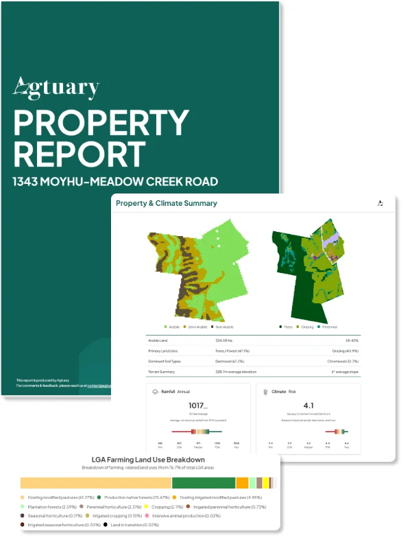
Map securities for credit review
Match titles to parcels, review ownership where licensed and attach environmental and sales context to each security.
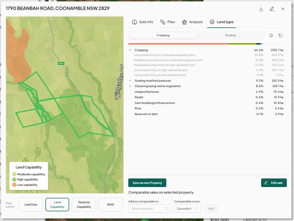
- Context for credit and risk teams
- Understand drivers of financial performance
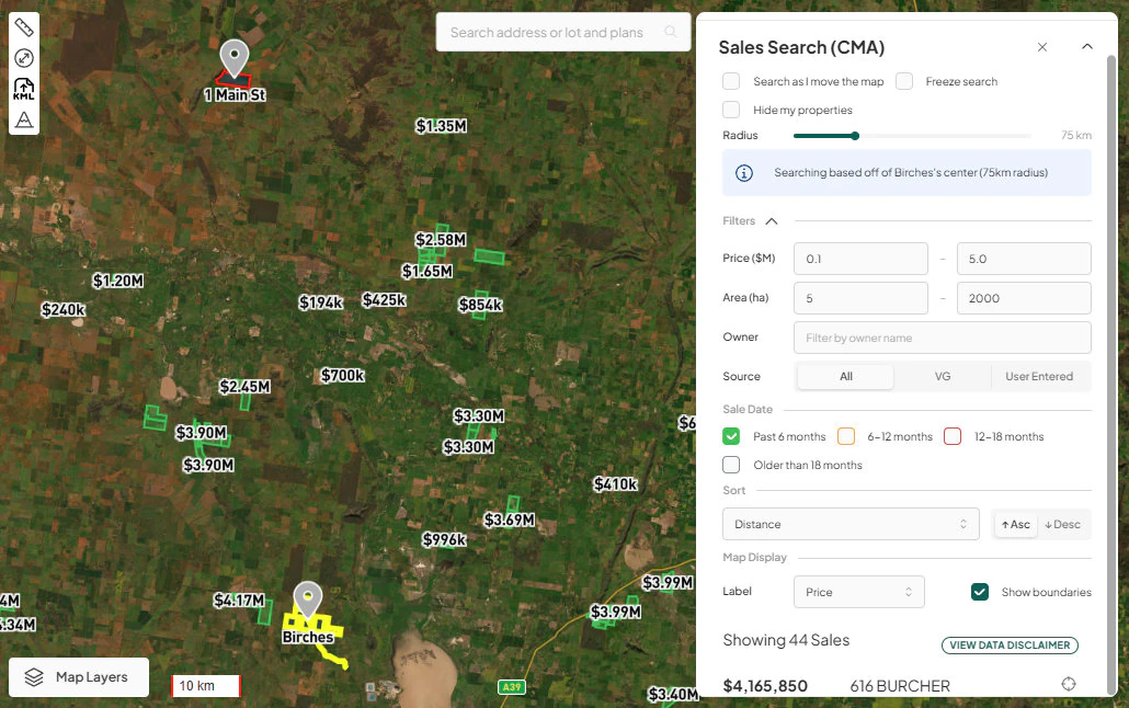
Support purchase and sale discussions
Use sales and land data when a customer is buying, selling or refinancing rural property.
- Review environmental history for a new purchase
- Prepare market information for a sale
- Keep property evidence with the customer file
See it in practice
Case studies
Agribusiness advisory
Colliers Agribusiness: mapping and planning natural capital
“Colliers International collaborates with multiple spatial data providers worldwide. In Australia, our Agribusiness team conducted a comprehensive review of all agriculture property specific platforms to map, measure, monitor and plan for our client's natural capital future. Agtuary was identified as our preferred partner to meet these needs of our Colliers Agribusiness clients. As an early enterprise agreement partner, we now benefit from regular updates at a developer level, combine with priority back-of-house services, and access to their significant relationships with ASX listed companies, which greatly benefit both our clients and the Colliers Agribusiness people & platform into the future.”
Read the Colliers International Agribusiness case study →Agricultural finance
Bullagreen Finance: client briefings, lenders and pre-auction reviews
“Since we've started using Agtuary to support our clients and inform our finance partners of their historical performance data, knowing their environment and understanding the comparable sales data we've seen a huge value add uplift from the paddock to the board room.”
Read the Bullagreen Finance case study →“In Australia, our Agribusiness team conducted a comprehensive review of all agriculture property specific platforms to map, measure, monitor and plan for our client's natural capital future. Agtuary was identified as our preferred partner to meet these needs of our Colliers Agribusiness clients.”
Frequently asked questions
- Can you map a rural lending book?
- Yes. Agtuary matches titles to parcels, maps portfolios and adds rural property data to each security. Automated rural matching success rates exceed 95%, and records that do not match automatically are reviewed manually.