Trusted by Australia's leading organisations
10+
Years of market data history
100M+
Data points
200+
Data layers
Minutes
Not months
Why Agtuary
More than just property data
Rural property is inherently tied to the environment, the land, and the climate. Without the full picture, you're only getting half the story.
A singular data solution
Property, land, climate, and environmental data unified in one platform. No more juggling multiple providers.
Insights in minutes, not months
Instantly generate professional KYE and CMA reports. Data that would usually take months to compile - ready now.
Complete & accurate data
Partnered with REA Group and PropTrack for 10+ years of market data history, ownership, and listings data.
Gain a market edge
Comprehensive rural property data for faster, better-informed decisions. Act on opportunities others miss.
Try the full platform free for 7 days
No credit card required. No setup fees. Cancel anytime.
Products & Features
Everything you need for rural property
Six powerful tools for property professionals, from due diligence reports to mobile inspections.
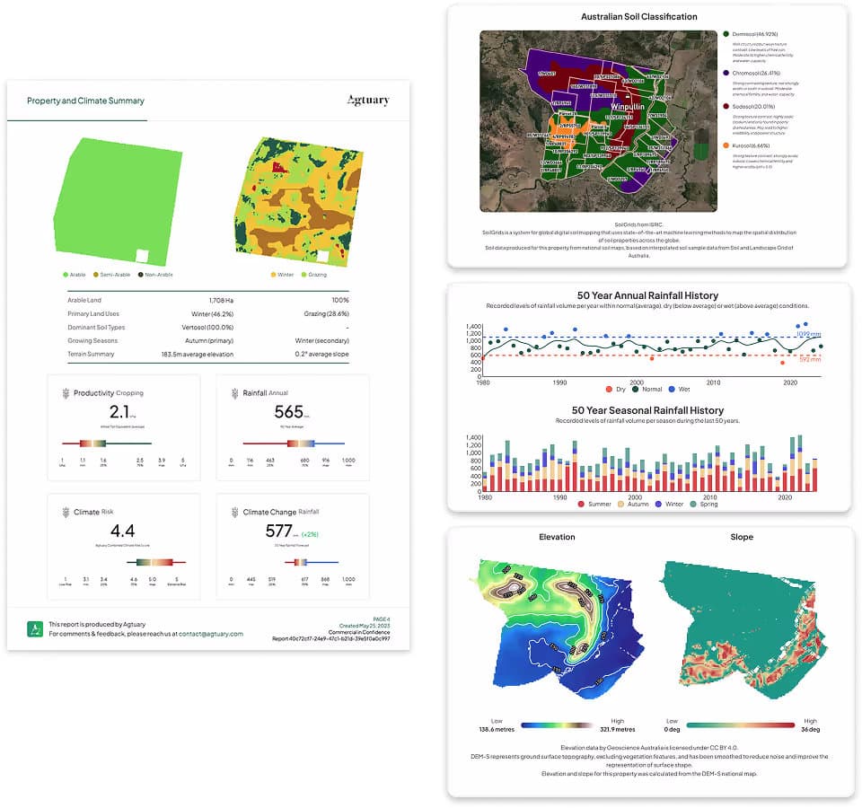
Know Your Environment (KYE) Reports
Land, climate & environmental insights in an instant.
Learn more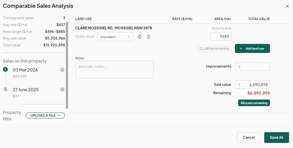
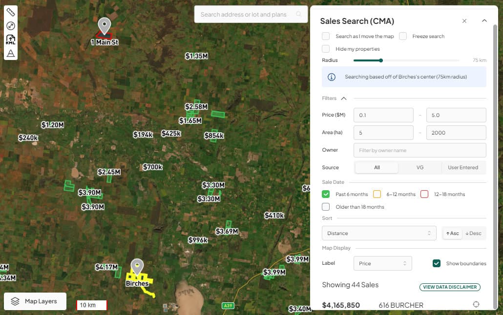
Comparative Market Analysis (CMA)
Data driven CMA specialised for rural property.
Learn more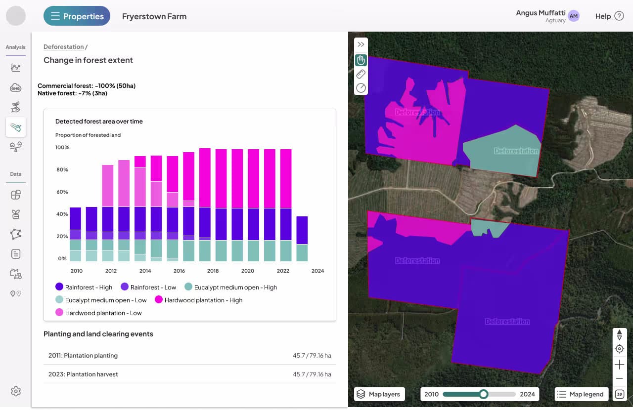
Property & Portfolio Deforestation Reporting
Compliant analysis and reporting for any location.
Learn more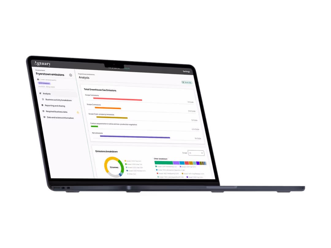
Agricultural Emissions Accounting
National Greenhouse Accounts compliant GHG accounting.
Learn more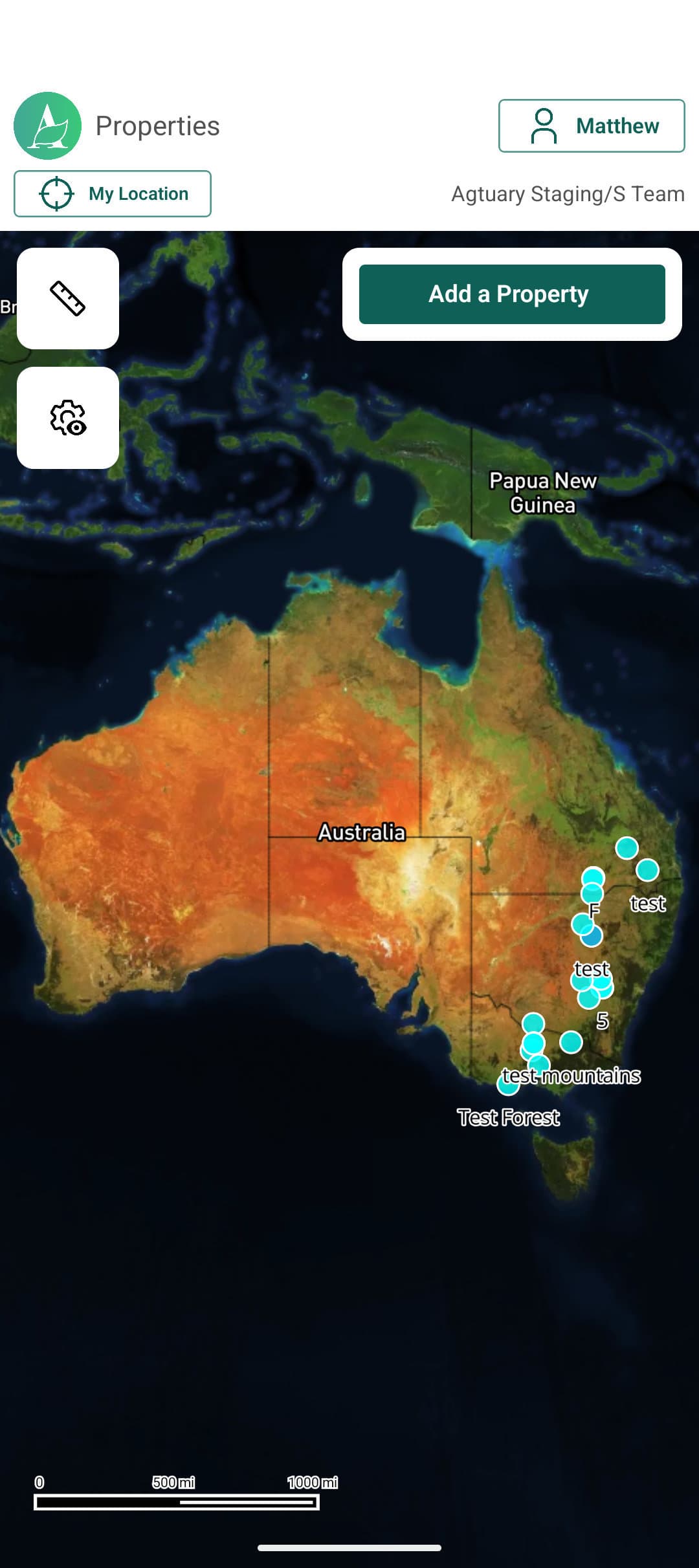
Mobile Property Inspection App
On-site inspection and data recording for due diligence.
Learn more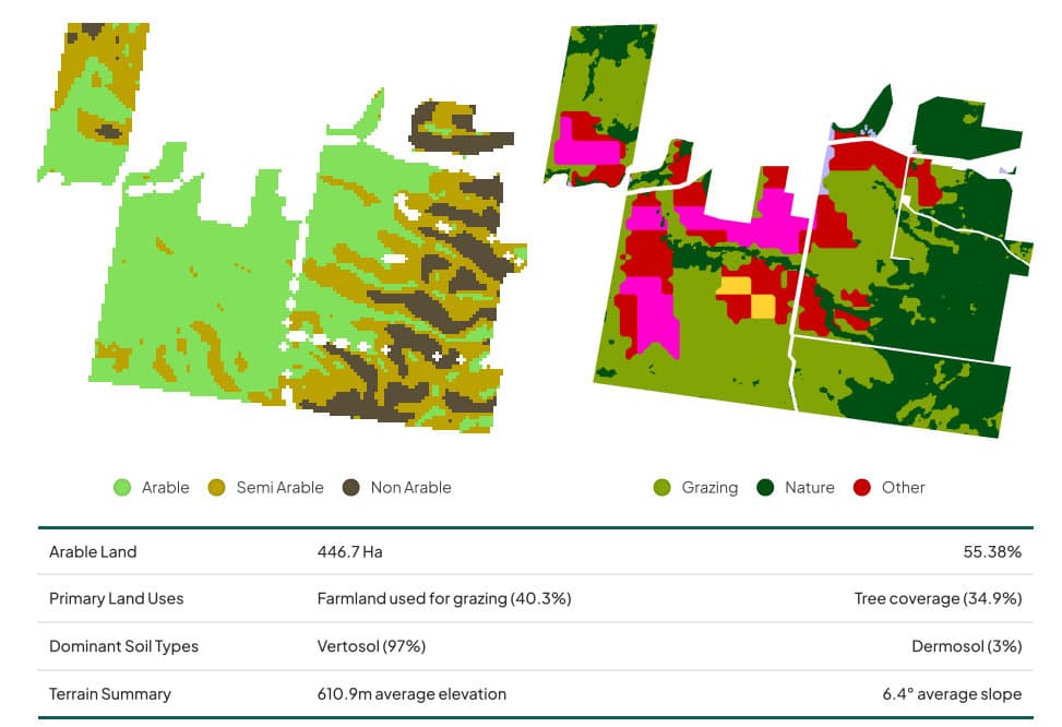
Mapping & Location Services
Bespoke geospatial analysis for land and sustainability.
Learn morePlatform
See the platform in action
Millions of data points. Hundreds of layers. One powerful platform built for Australian rural property.
Free Sample
See a KYE report in action
Not ready for a trial? Enter your email and we'll send you a complete sample Know Your Environment report - property, land, climate and environmental insights included.
We respect your privacy. Unsubscribe at any time.
Industries
Built for your industry
From boutique agencies to enterprise organisations, Agtuary serves professionals across rural property.
Testimonials
Trusted by industry leaders
“Agtuary was identified as our preferred partner to meet the needs of our Colliers Agribusiness clients after a comprehensive review of all agriculture property platforms.”
“Since we've started using Agtuary, we've seen a huge value add uplift from the paddock to the board room. In Ag, this platform stands alone and unrivalled.”
“The in-depth data we can now provide with the Agtuary reporting system is a complete game changer. This gives me a significant point of difference to my competitors.”